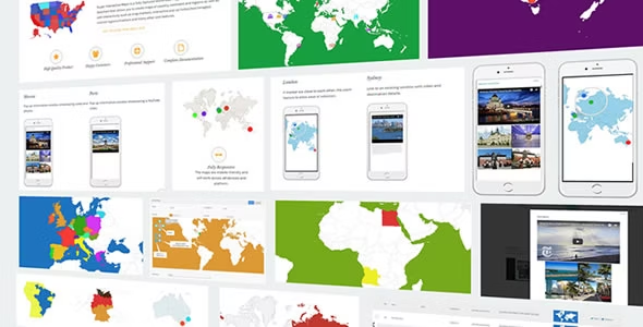
Super Interactive Maps by MacroXoft is an advanced WordPress plugin that leverages the Google Geochart API to create highly interactive and customizable maps of countries, continents, and regions:
1. Feature-Rich Mapping Capabilities:
- Map Creation: Enables easy creation of dynamic maps directly within WordPress, supporting geographical representations at various scales.
- Custom Markers: Allows users to place custom markers on the map to pinpoint specific locations of interest, such as hotels, cafes, airports, and other points of significance.
- Marker Customization: Provides options to customize markers with icons, labels, and tooltips, enhancing visual clarity and user interaction.
2. Interactive Map Elements:
- Interactive Labels: Incorporates interactive labels that display additional information or details when clicked or hovered over, improving user engagement and information accessibility.
- Lightboxes: Integrates lightbox functionality for displaying multimedia content, such as images or videos, linked to map markers or regions.
- Web Content Linking: Enables linking map elements directly to external web pages or internal content within the WordPress site, facilitating seamless navigation and access to related information.
3. User-friendly Interface and Design:
- Intuitive Dashboard: Features a user-friendly admin dashboard for easy map configuration, marker management, and customization settings.
- Responsive Design: Ensures maps are responsive and adapt well to different screen sizes and devices, optimizing user experience across desktops, tablets, and smartphones.
4. Integration and Compatibility:
- Google Geochart API Integration: Utilizes the powerful Google Geochart API for reliable map rendering and data visualization, ensuring accuracy and performance.
- WordPress Compatibility: Fully compatible with WordPress CMS, supporting seamless integration, installation, and management within the WordPress environment.
5. Extensive Use Cases:
- Business Applications: Ideal for businesses to showcase global or regional presence, display branch locations, or highlight service areas.
- Educational Purposes: Suitable for educational institutions to illustrate geographical studies, demographic data, or historical locations on interactive maps.
- Tourism and Travel: Enables tourism websites to feature interactive maps with key attractions, accommodations, and points of interest for travelers.
6. Support and Updates:
- Dedicated Support: MacroXoft provides dedicated customer support to assist users with plugin installation, setup, troubleshooting, and customization queries.
- Regular Updates: Receives regular updates with new features, enhancements, and bug fixes to maintain compatibility with WordPress updates and ensure optimal performance.


Reviews
There are no reviews yet.